top of page


What You Get from Drone LiDAR Mapping
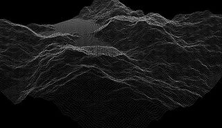
3D Point Clouds
Millions of precise measurements that recreate your site in full 3D, ready for engineering, design, and planning software.

Bare Earth Terrain Models
LiDAR sees through the forest canopy to the ground below, giving you an accurate surface model even in dense northwest BC forest.

Contour and Topographic Maps
Survey‑grade contours and elevation maps for road layout, drainage planning, and site design.

What Drone LiDAR Mapping Produces

How Our Drone LiDAR Mapping Process Works

Plan
We define your site boundaries, accuracy needs, and deliverables.
Mobilize
Our crew deploys from Terrace, so we reach your site in days, not weeks.


Capture
We fly your site and collect high‑density LiDAR data.
Process and Deliver
We turn raw data into point clouds, terrain models, and maps in the formats you use.


bottom of page